


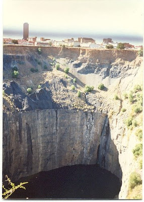
From mid-July 1871 to 1914 up to 50,000 miners dug the hole with picks and shovels, yielding 2,720 kilograms (6,000 lb) of diamonds. The Big Hole has a surface of 17 hectares (42 acres) and is 463 metres (1,520 ft) wide. It was excavated to a depth of 240 metres (790 ft) but then partially infilled with debris reducing its depth to about 215 metres (710 ft) since then it has accumulated water to a level 40 metres (130 ft) below the surrounding land surface, leaving 175 metres (570 ft) of the hole beneath water. The underground Kimberley Mine was mined to a depth of 1097 metres.
There is currently an effort in progress to register the Big Hole as a World Heritage Site.


The Great Blue Hole is a large underwater sinkhole off the coast of Belize. It lies near the center of Lighthouse Reef, a small atoll 100 kilometres(62 mi) from the mainland and Belize City. The hole is circular in shape, over 300 metres (984 ft) across and 125 metres (410 ft) deep. It was formed as a limestone cave system during the last glacial period when sea levels were much lower. As the ocean began to rise again, the caves flooded, and the roof collapsed. Believed to be the world’s largest feature of its kind, the Great Blue Hole is part of the larger Belize Barrier Reef Reserve System, a World Heritage site of the United Nations Educational, Scientific and Cultural Organization (UNESCO).
On-shore caves of similar formation, as large collapsed sinkholes, are well known in Belize, and in the Yucatan Peninsula, where they are known as "cenotes".
This site was made famous by Jacques-Yves Cousteau who declared it one of the top ten scuba diving sites in the world. In 1971, he brought his ship, the Calypso, to the hole to chart its depths.[4] Investigations by this expedition confirmed the hole's origin as typical karst limestone formations, formed before rises in sea level in at least four stages, leaving ledges at depths of 21, 49 and 91 meters (69, 161 and 299 ft). Stalactites were retrieved from submerged caves, confirming their previous formation above sea level. Some of these stalactites were also off-vertical by 10°-13° in a consistent orientation, thus indicating that there had also been some past geological shift and tilting of the underlying plateau, followed by a long period in the current plane.


6. Diavik diamond mine - Canada
The Diavik Diamond Mine is a diamond mine in the North Slave Region of the Northwest Territories, Canada, about 300 kilometres(186 miles) north of Yellowknife. It has become an important part of the regional economy, employing 700, grossing C$100 million in sales, and producing 8 million carats (1600 kg) of diamonds annually. The area was surveyed in 1992 and construction began in 2001, with production commencing in January 2003. It is connected by an ice road and Diavik Airport with a 5,235-foot (1,596 m) gravel runway regularly accommodating Boeing 737 jet aircraft.

The mine is owned by a joint venture between the Harry Winston Diamond Corporation and Diavik Diamond Mines Inc., a subsidiary of Rio Tinto Group. The lifespan of the mine is expected to be 16 to 22 years.
The mine consists of three kimberlite pipes associated with the Lac de Gras kimberlite field and is located on an island 20 square kilometres (8 sq mi) in Lac de Gras and is informally called East Island. It is about 220 kilometres (137 mi) south of the Arctic Circle.
In 2006 the ice road from Yellowknife to the Diavik mine, and neighboring mines, froze late and thawed early. The Diavik mine was unable to truck in all the supplies needed for the rest of 2006 before the road closed and arrangements had to be made to bring the remainder of the supplies in by air.

7. Sinkhole-Guatemala
In February 2007 a large sinkhole opened in a poor neighborhood in northeast Guatemala city, killing three people. The sinkhole was 100.5 m (330 ft) deep, and apparently was created by fluid from a sewer dissolving the rock underneath. As a result,one thousand people have been evacuated from the area. [15] The sink hole has since been mitigated and plans to develop on the site have been proposed.


8. Chuquicamata mine - Chile
Chuquicamata, or "Chuqui" as it is more familiarly known, is a large open pit copper mine in the north of Chile, 215 km northeast of Antofagasta and 1,240 km north of the capital, Santiago.

For many years it was the mine with the largest annual production in the world but was recently overtaken by Minera Escondida. Nevertheless it remains the mine with by far the largest total production of approximately 29 million tonnes of copper to the end of 2007 (excluding Radomiro Tomić). Despite over 90 years of intensive exploitation it remains one of the largest known copper resources. Its open pit is one of the largest at 4.3 km long, 3 km wide and over 850 m deep and its smelter and electrolytic refinery (855,000 tonnes p.a.) are amongst the world's largest. Chuquicamata is also a significant producer of molybdenum.
Chuquicamata is now amalgamated with the operating Radomiro Tomic mine to the north (but still on the same mineralised system), the developing Alejandro Hales mine just to the south (formerly Mansa Mina, a slightly impolite description) and the recently discovered 'Toki cluster' of copper porphyries to form the Codelco Norte division of Codelco


0 comments:
Post a Comment